
RC Flying Today: Get Your Own Flying Site!
George M. Myers
ABSTRACT: Bergen County Model Aerodrome; Guide to San Diego County Modeling; AUTOMAP™; LORAN source.
GET YOUR OWN FLYING SITE!
This story started in 1985 when the last model flying site within the boundaries of Teaneck, New Jersey, and surrounding towns was closed. Joe Beshar (198 Merritt Drive, Oradell, New Jersey 07649) decided the time had come to obtain land in Bergen County for use as a flying site.
Joe made an official presentation to the Bergen County Freeholders (county government) on the subject of a permanent model airport. The presentation had four parts:
- Model aviation requires its participants to become familiar with the sciences and is therefore beneficial to the education of participants of all ages — from youth to senior citizens.
- Government has a responsibility to support model aviation for the same reasons and in the same way it already supports football, soccer, baseball, horseback riding, archery, pistol and rifle shooting, tennis, golf, etc. Joe stressed that permanent model airports are necessary.
- Model aviation protects the environment because it doesn't require things to be uprooted, paved over, seeded or mowed short as many of the activities listed above do.
- Model flying operations have become less safe because of government's failure to provide suitable places to fly.
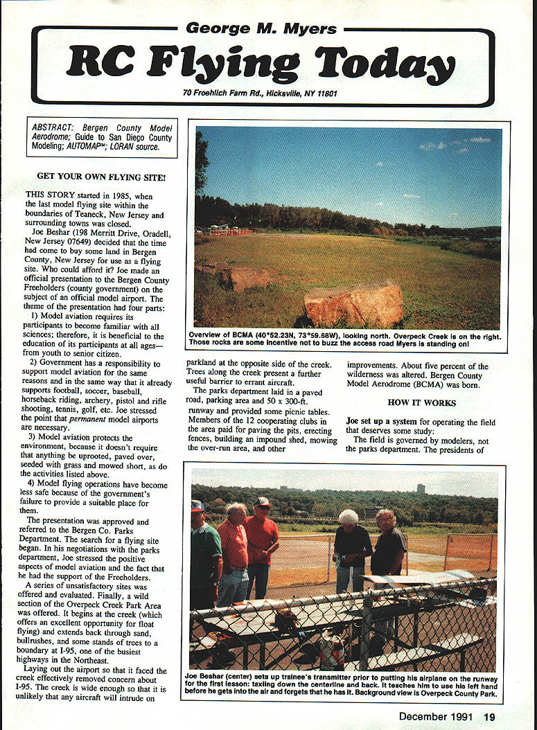
The presentation was approved and referred to the Bergen County Parks Department. A search for a flying site began. Joe emphasized the positive aspects of model aviation and the fact that he had the support of the Freeholders. After a series of unsatisfactory sites, a wild section of the Overpeck Creek Park area was offered. It begins at the creek (an excellent opportunity for float flying) and extends back through sand, bullrushes and some stands of trees to a boundary at I-95, one of the busiest highways in the Northeast.
Laying out the airport so it faced the creek effectively removed concern about I-95. The creek is wide enough that aircraft are unlikely to intrude on parkland on the opposite side. Trees along the creek provide a useful barrier to errant aircraft.
The Parks Department installed a paved road, parking area and a 50 x 300-ft runway and provided some picnic tables. Members of the 12 cooperating clubs in the area paid for paving the pits, erecting fences, building an impound shed, mowing the over-run area and other improvements. Only about five percent of the wilderness was altered. Bergen County Model Aerodrome (BCMA) was born.
HOW IT WORKS
Joe set up a system for operating the field that deserves study. The field is governed by the modelers, not the Parks Department.
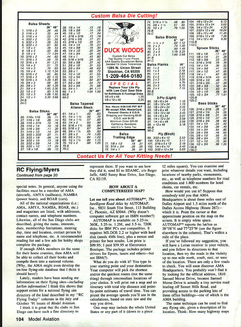
- Governance: The presidents (and delegates) of the 12 clubs registered to use the facility formed an ad hoc committee. The committee meets once per month at the Oradell Library and sets policy for use of the field. The committee elects officers — chairman, vice chairman, secretary/treasurer, coordinator and chief marshal. At the time of this account, Joe Beshar was chairman; Ron Tropeau vice chairman; Vic Bock secretary/treasurer; Henry Lewis coordinator; and Larry Kraus chief marshal.
- Field marshals: The club provides field marshals to police operations. People who break rules are given a written warning and must answer in writing to the vice chairman. Persistent violators can have flying privileges revoked for a period the committee deems sufficient.
- Membership and permits:
- No guest flying is permitted. Independent fliers given permits must join one of the registered clubs. To start your own club you must be accepted by the committee.
- Clubs seeking access must submit an application to the chairman for a permit to fly at BCMA, accompanied by a copy of the club's AMA charter certificate and insurance naming the club (and county), a club membership list, and a $50 fee to the county. Exceptions are made for clubs joining after March 31.
- Pilot qualifications:
- New pilots receive a Red Trainee Flying Permit.
- Pilots who have won Pattern Nationals or equivalent must still demonstrate proficiency to a designated checkout pilot before receiving a Pilot Permit.
- Any club instructor can train pilots.
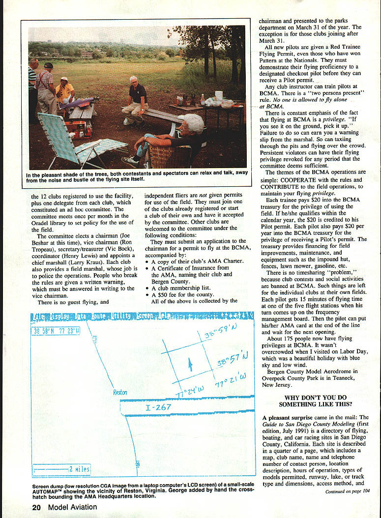
- BCMA enforces a two-person-present rule — no one is allowed to fly alone.
- Safety and conduct: BCMA places constant emphasis on safe flying. Rules include “If you see it on the ground, pick it up.” Violations such as taxiing through the pits or flying over the crowd can earn warning slips from the marshal.
The themes of BCMA operations are simple: cooperate with the rules and contribute to field operations to maintain your flying privilege.
- Fees and finance:
- Each trainee pays $20 into the BCMA treasury for the privilege of using the field. If he/she qualifies within the calendar year, the $20 is credited to the Pilot permit.
- Each pilot pays $20 per year into the BCMA treasury for a Pilot's permit.
- The treasury funds field improvements, maintenance and equipment such as the impound hut, fences, lawn mower, gasoline, etc.
- Flying procedures:
- Club contests and social activities are banned at BCMA to avoid timesharing problems; such activities are left to individual clubs at their own fields.
- Each pilot gets 15 minutes of flying time at one of the five flight stations when his/her turn comes up on the flight management board. Then the pilot places his/her AMA card at the end of the line and waits for the next opening.
About 175 people have flying privileges at BCMA. The site was not overcrowded during visits (example: Labor Day, clear skies and low wind).
Location
Bergen County Model Aerodrome in Overpeck Creek Park is in Teaneck, New Jersey.
Special notes
- In general, anyone using the facilities must be a member of the appropriate national organizations when applicable: AMA (aircraft), AMYA (sailboats), NAMBA (power boats), and ROAR (cars).
- A directory was compiled listing all the national organizations (AMA, AMYA, NAMBA, ROAR, etc.) and magazines with addresses, contact names and telephone numbers. San Diego clubs were described with name, interests, dues, membership limitations, meeting day/time/location, contact person and telephone. A recommended reading list and a few hobby shop ads completed the package.
- If enough AMA members produce similar county directories, AMA could compile a national volume or even develop an online flying-site database.
- Readers have been sending flying-site information, including lat/lon coordinates, supporting the idea of a national flying-site directory. For an example of a well-done local directory, send $1 to SDAMC, c/o Roger Jaffe, 6462 Sunny Brae Drive, San Diego, CA 92119.
HOW ABOUT A COMPUTERIZED MAP?
Let me tell you about AUTOMAP™, The Intelligent Road Atlas by AUTOMAP, Inc., 9831 South 51st Street, Building C-113, Phoenix, AZ 85044.
AUTOMAP is available on 5.25-in. 360K, 5.25-in. 1.2M, and 3.5-in. 720K disks for IBM PCs and compatibles. It requires MS-DOS 2.2 or higher with a hard disk (needs 4 MB free), plus a mouse and printer for best results. List price was $99.95; the author paid $59.95 at Electronics Boutique. The package includes printer drivers for Epson and various laser printers.
What it does:
- You type in a starting point and a destination. The software finds the shortest and/or quickest routes (not necessarily the same) through intermediate locations of your choice.
- It prints a map and itinerary with total trip distance and point-by-point estimated travel times. You can preset average speeds used in calculations.
- A map may include the whole United States or any part of it (down to a piece about 12 miles square). You can examine and print details such as nearby parks, monuments and phone numbers for road conditions or national chains.
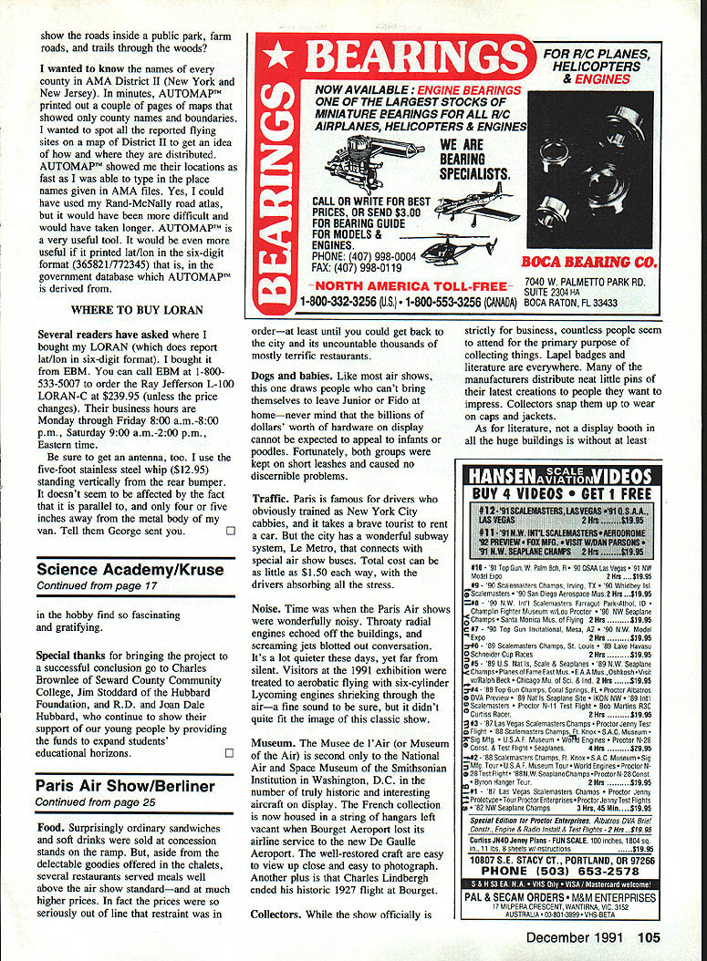
Practical use: Suppose someone tells you that AMA Headquarters is about three miles east of Dulles Airport and 1.5 miles north of the Dulles Access Highway (Route 267). On the AUTOMAP screen that spot may appear as empty white space, but AUTOMAP reports lat/lon (example: about 38°38' N, 77°23' W) — often within a mile of the location. If you have a Loran receiver in your vehicle and follow its directions to the vicinity, you can search the local roads and find the exact building (official addresses sometimes refer to tiny service roads that don't appear prominently on maps).
The same technique can be used to find almost any flying site given a descriptive location. Think: how many highway maps include the detailed information you need?
Transcribed from original scans by AI. Minor OCR errors may remain.

